Last fall Joe and I stood on top of Telescope Peak in Death
Valley looking west into the distance. Our conversation went something like this:
J: Yep, those are the White Mountains. And that there, that’s
Mt. Whitney.
E: Let’s climb it!
J: Yes, lets.
 |
| Mt. Whitney, Sierra Nevada range, near Lone Pine, CA |
So, we went home and looked into the permit process and
found out that, indeed, there is one. But before things went much further,
inclement weather turned us away from our hopes and dreams for the rest of the
season. Whitney is not a mountain you’ll soon forget, however, so when spring
came ‘round we contacted the ranger station and tried to get a permit.
Evidently, permits are reserved for people who plan ahead. Rather than try
again next year, the ranger suggested that we show up the day before our hike and
try to grab a permit that hadn’t been picked up. The problem with this approach
is that the only permit we would likely get would be for a single day, rather
than overnight. So, with that in mind we prepared ourselves for climbing Mt.
Whitney, the tallest peak in the contiguous U.S., in a single day.
 |
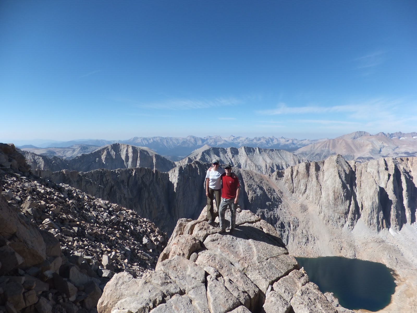
| On the summit! |
Given the length and popularity of the 21.4 mile trail, Joe
and I decided to cut things short and take the more direct mountaineer’s route
up. This was the plan until we found ourselves sitting at the Mt. Whitney
campground two nights ago and I informed Joe that I would not be joining him on
the mountaineer’s route the next morning.
The last 500 feet of perilous
cliff exposure had been weighing on my mind but it wasn’t until go time that I
totally chickened out. Handsome guy that he is, he simply suggested that we
take the normal route up. So we did. 10.7 miles up, and 10.7 miles down. No
short cuts. But, to my absolute shock, it was fun, easy, and an overall
complete success. Neither of us suffered from the altitude woozies, which has
never happened to me before. And my usual method of dealing with it is to take
ten steps at a time while weeping until I reach the top. None of that on this
hike! Because it was such an awesomely pleasant experience, I wanted to share
what we did in the event that anyone else out there is interested in hiking Mt.
Whitney in a day. A lot of this would apply to the more common approach of
camping along the trail as well.
Deal Breakers:
Let’s just get these out of the way right quick.
- Everything you bring into the Mt. Whitney Zone (trail or mountaineer’s route) you have to bring out. Including *ahem* bodily waste. Please, just do a different hike if you can’t stomach the thought of carrying out your poop. (And if you’re really lucky, your husband’s too!) There are no trash cans anywhere on the trail due to high bear activity.
- Permits are required for any activity within the Whitney Zone. If you can’t get one, but decide to go anyway, don’t be surprised if you get smacked with a ticket. On the website they state that ignorance is no exception, so you won’t be able to cry your way out of this one.
 |
| The toilet bag which comes with the permit :) |
Now the fun stuff.
Prep work:
Joe and I spent a few months preparing here and there, then
went full bore during the 3 weekends leading up to our hike. We did a mix of
endurance (18 miles) and high-elevation (13,500’) practice hikes. In addition
to the obvious reason of strengthening the legs, these hikes were also
important because it helped us realize parameters. For example, I get cold
easily, so I carry more layers than Joe. I also drink more water than he does. When
hiking Whitney we knew we would only want to carry up what was absolutely
necessary, so we used these hikes to weed out the extras.
The day before:
There was no guarantee that we could get a permit, so we
wanted to arrive as early as possible. Leaving from southern Nevada, early
meant 2 pm. Luckily things fell into place and we had no trouble getting a day hike permit (free of charge).
We ate a huge lunch in Lone Pine, the kind that keeps you
nice a full for the rest of the day and most of the next morning. After lunch we set out for the Mt. Whitney
camp ground where we pitched our tent, read, then ate a good sized dinner.
Hungry or not, we needed the calories. The Whitney Portal has really delicious
burgers. In fact, that is all they have. They come with a thick slice of cheese
and all the other delicious and appropriate toppings, and a whole lotta fries. Then,
at 8pm we went to bed.
The hike:
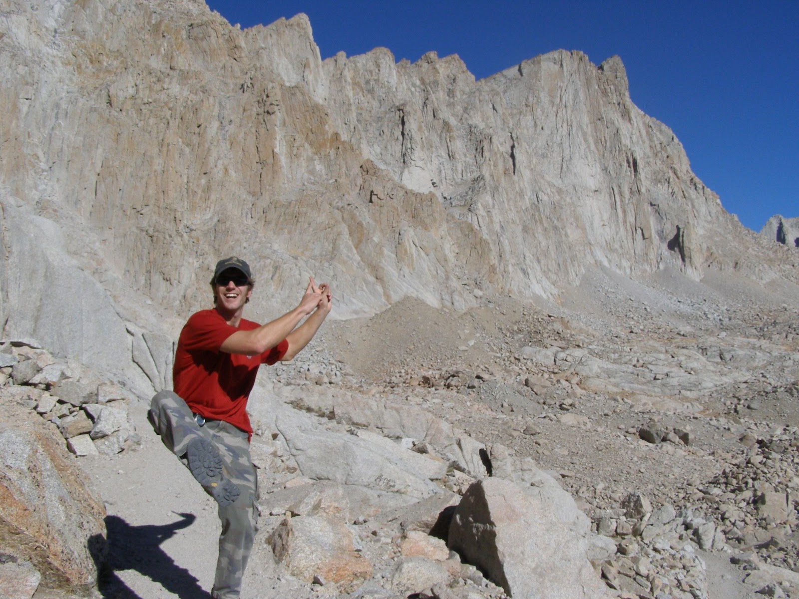 |
| Joe, pointing towards the peak while working our way up the switch backs. |
Our day started at the pleasantly dark hour of 4 am. We got
all gussied up, then took down the tent and packed our backpacks. At 4:45 we
hit the trail, eating a mini-loaf of banana bread as we walked. The sun started
coming up after about 2.5 miles, but the trail is well defined and gradual so
there was absolutely no danger in hiking in the dark. At 3.5 miles the scenery
changes as you walk along a meadow to the first camp ground. Shortly after that
you pass Mirror Lake (4 miles) where we stopped for a breakfast break. We
each drank a Starbucks Double Shot and ate a granola bar. We had also been
careful to drink a lot of water.
After mirror lake you continue through the basin, slowly
gaining elevation for 2 miles until you reach the second camp ground. At this
point we had been hiking for almost 4 hours, so we stopped again for a snack
break and refilled our water bottles. This was a really nice place to stop and
rest before embarking on the 2+ miles of switchbacks that would bring us to the
crest. We also made friends with a curious marmot, which was nice.
 |
| Looking down at the switch backs. The trail passes between those two lakes. |
And so the switchbacks began. They are almost laughably
shallow, at times it seems like you're only a foot or two higher than the previous one. But
that’s what makes this trail accessible to all. By the time you reach the crest
you are almost 14,000 feet high. And that’s not even the best part. Have a look
to the west and try not to lose your footing when you see those views. Holy cow
it will make you wonder if you’ve ever seen anything more beautiful. Then it
will make you want to finish this hike so you can go climb one of those guys.
Needless to say, this is another good resting spot, if for nothing else you can
snap some photos.
 |
| On the crest, 2 miles from the summit. |
You’ll lose a little elevation in order to meet up with the
Muir trail, then proceed to climb the last 500 feet over the course of 2 miles.
Again, this trail is quite gradual. There is a large cabin on the peak which is
visible from lower down on the trail and will give you the gumption to reach the top, at 14,505 feet. And that’s it. No tricky route finding, nothing at all technical. The only
thing you have to prepare for is distance, and potential altitude sickness. In mid-September the weather couldn't have been better-- light wind, sunny with clear skies.
 |
| View of the route from the peak. The trail is visible in this photo, it follows the ridge. |
At the peak we ate a hearty meal of potatoes, bread,
avocadoes, crackers and apples. We also took an Advil to try and avoid pains on
the way down. We stayed up there about an hour enjoying the views and letting
our legs rest, then headed down. We continued to snack on cliff bars, trail
mix, and more apples while we walked to keep our energy up. We also had
Gatorade, which was a big energy booster. We had to refill all of our water
bottles again at the camp ground, further demonstrating that we were drinking quite a bit
of fluids.
We arrived back at the trailhead almost 13 hours to the dot after
we left. We both felt very energized and happy about the journey. After eating
another burger from the portal, we took off for home. Last night I slept like a
champion.
A break down of our food:
Breakfast- banana bread loafs packed with strength; Nature Valley granola bars; Starbucks Double Shot
Snacks- trail mix; hard boiled eggs; apples; cliff bars; dark chocolate
Lunch- Mexican potatoes with avocados, bread, crackers, apples; bagels and peanut butter (didn't end up eating)
Liquids- 3 32oz water bottles; 2 32oz Gatorade
Wildlife spotted:
Pikas, Marmots, Peregrine falcon
 |
| Mt. Whitney trail head after the ascent. |
A break down of our food:
Breakfast- banana bread loafs packed with strength; Nature Valley granola bars; Starbucks Double Shot
Snacks- trail mix; hard boiled eggs; apples; cliff bars; dark chocolate
Lunch- Mexican potatoes with avocados, bread, crackers, apples; bagels and peanut butter (didn't end up eating)
Liquids- 3 32oz water bottles; 2 32oz Gatorade
Wildlife spotted:
Pikas, Marmots, Peregrine falcon
3 comments:
Wow! Those are some beautiful photos. Were you with other people or did you do some fast running with a timer to get that picture with the mountains in the background?
So glad it went smoothly and you both enjoyed it.
Thanks!
@Carol- we offered to take pictures of a group that was taking a break near us, then they reciprocated. Thank goodness for their offer, otherwise we would have missed out on that nice shot:)
Post a Comment